News
Drone Survey of Completed Section of A6 Randalstown to Castledawson
2 Jan 2020
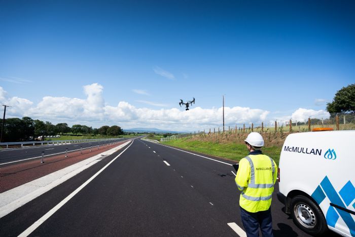
E McMullan Ltd were recently asked to provide aerial images of the newly completed section of the A6 Randalstown to Castledawson Dualling Scheme for the client GFJV. This was carried out using an DJI Inspire 1 Pro Quadcopter with a Zenmuse X5 camera
Our professional surveying UAV, the Sensefly eBee, was also used for a pre-construction LiDAR flyover of the entire 14km scheme in 2015, providing the client with a full 3D Point Cloud Model of both Zone 1 and Zone 2