UAV Surveys

Our new UAVs enable us to offer highly accurate, efficient and time saving surveys with a varied range of potential uses.

Our Aerial Surveys

Sensefly eBee

Sensefly eBee

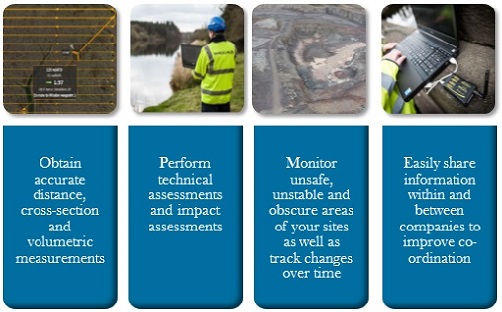
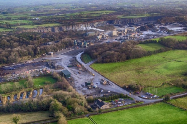
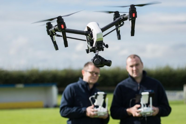
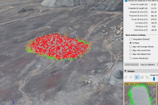
The Sensefly eBee is a fully integrated system which produces GIS ready data fit to be used with a wide range of geospatial programs. Sites which have proven difficult or dangerous to access can now be accurately, safely and rapidly surveyed using the UAV. This new technology combined with our extensive surveying experience ensures you receive relevant and reliable results.

Operators

Operators

Two fully BNUC-S trained pilots work within the company and ensure all work is carried out safely and legally. Our UAV operators have extensive experience in surveying and GIS. We have been granted permission for aerial work from the CAA and are fully insured to carry out surveys safely and in compliance with Article 167 of the Air Navigation Order (CAP 393).


Outputs

Outputs

UAV surveys gather a much wider range of georeferenced information in one flight than is obtained from a standard ground survey. This Added Value Data includes shapefiles, georeferenced photography, Point Cloud data in LiDAR format, Digital Elevation Models Orthomosaic photography and video imagery and is immediately available for use. The data provides a digital 3D representation of your site which can be accessed immediately when the need arises.

Accuracy

Accuracy

With the UAV it is possible to achieve highly accurate datasets with the possibility of attaining absolute X, Y, Z coordinates of down to 3cm accuracy. We use ground control points to ensure that we provide our clients with the most accurate results possible. 


Inspire Pro 1

Inspire Pro 1

With our new Inspire pro 1 quadcopter we can now offer video imagery as part of our aerial survey packages. This simple, ready to fly system can provide a complete and unobstructed 360° view while the built in technology ensures the UAV remains stable during flight allowing the capture of smooth video and sharp images. 

Example Uses


For information on aerial surveys, to see sample data or to organise a demonstration contact us at:

UAV@emcmullan.co.uk

Case Studies